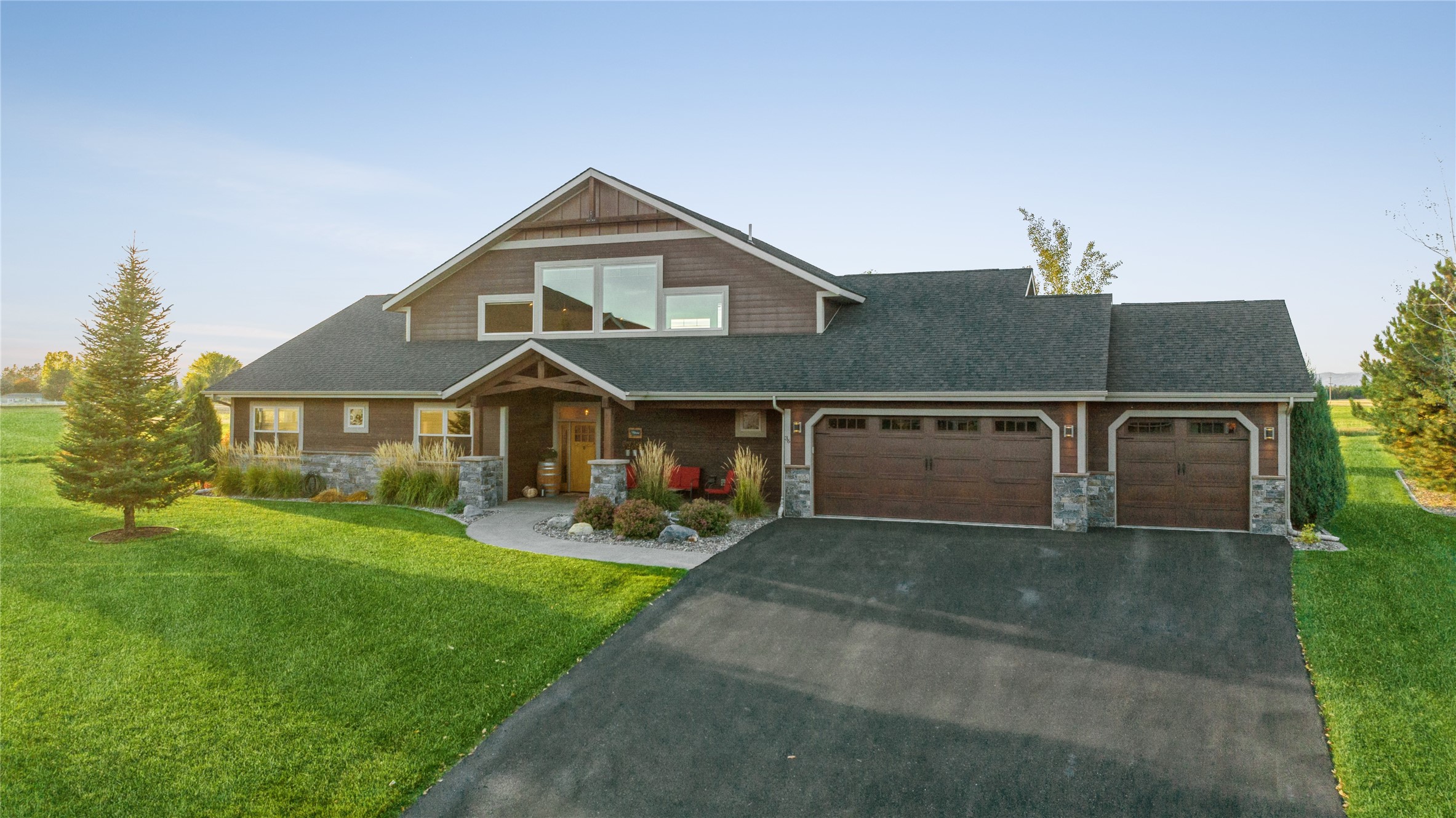
Kalispell Real Estate Listings

Kalispell, Montana
Kalispell, Montana is part of a larger land of opportunity that is being discovered and embraced throughout the Flathead Valley.
There are several areas of interest in the Kalispell region, and with our Kalispell real estate listings you can see them all, including Downtown Kalispell, Lower Valley (south and southeast of downtown), Southwest of town (Kila, Ashley Lake), West Valley, Evergreen, East Valley (Lake Blaine, Creston) and North Valley (between Whitefish and Kalispell.) Each of these sectors of Kalispell, Montana have varying attributes. The area is rich with real estate opportunities for every type of buyer.
Kalispell real estate listings, including waterfront properties in the greater Kalispell area, are quite common due to the geography of the mountains enclosing the valley floor. Melt water makes its way to Flathead Lake in one way or another by way of the abundant Flathead Valley. From the surrounding Salish Mountains to the west, Whitefish and Lewis Ranges to the north and the Flathead and Swan Ranges to the East, waterfront properties can be found throughout the Kalispell area. Each region of the Flathead Valley surrounding Kalispell is unique. For those who want waterfront properties in the Kalispell area, familiarity with the different regions will help you decide which distinctive waterfront property you can't live without.
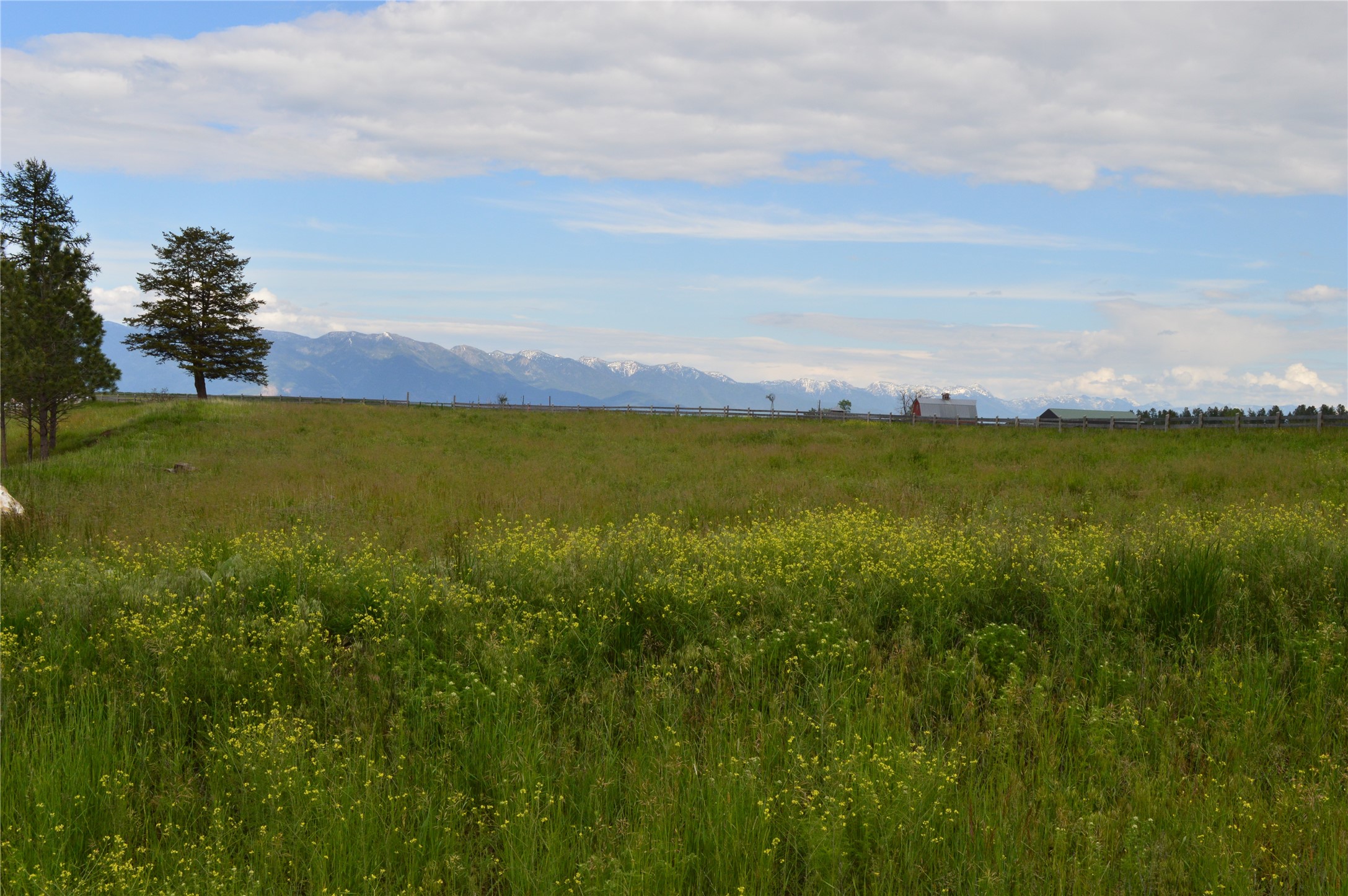
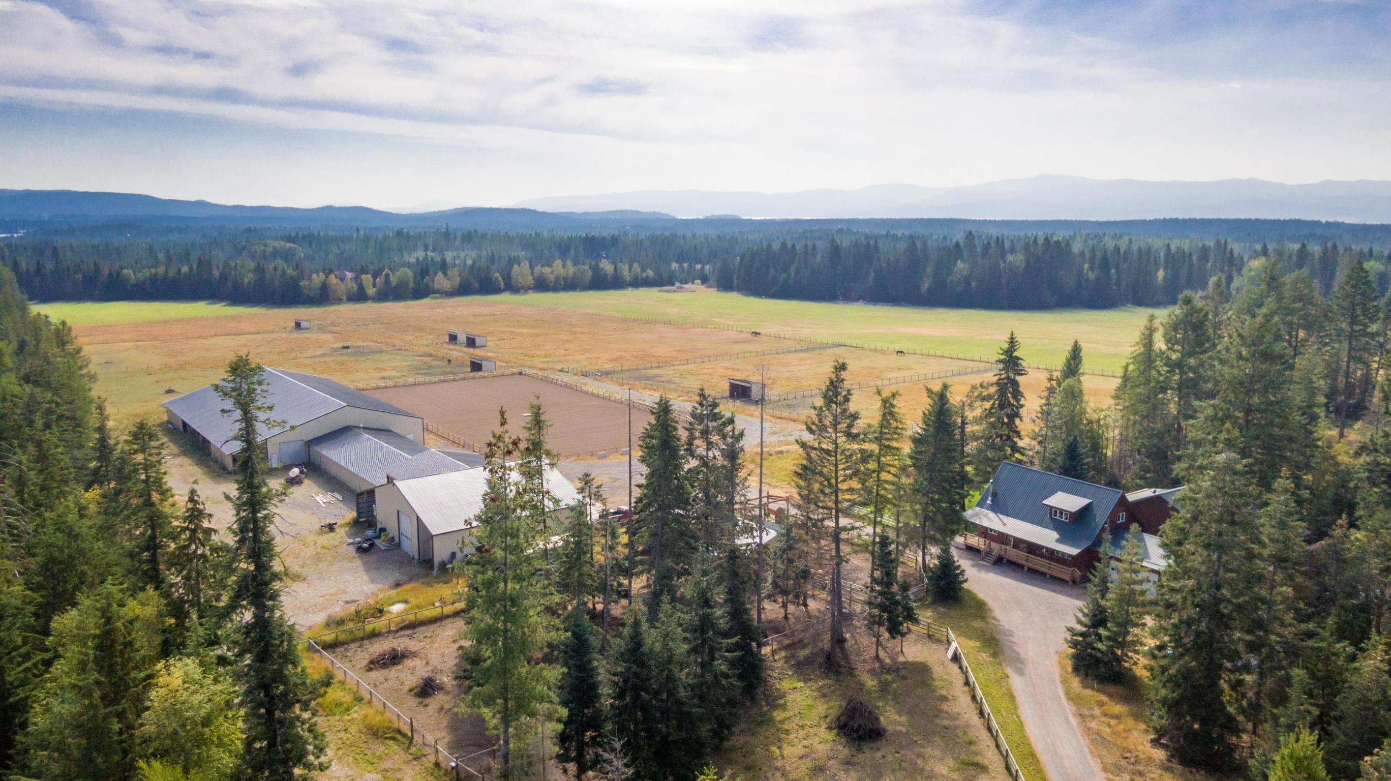
The expansive Flathead Valley also has a lot of real estate opportunities with acreage. Properties for horses or farming abound. Kalispell, Montana ranches are for sale in each region. Many who relocate to the Flathead Valley are looking for ranches for sale, horse or farming properties or overall property with acreage.
The location is prime for the extreme variety of activities and entertainment that is in your grasp from Kalispell real estate listings. Glacier National Park is just over 30 miles from Kalispell city proper. Flathead Lake is 7 miles south. The Glacier Airport is 7 miles north. The festive area of Whitefish is less than 15 miles north. Encompassing the Kalispell region is over 3 million acres of protected wilderness. Everywhere you turn is an opportunity for recreation and beauty.
There isn't a bad seat in the house, so to speak when speaking of scenic views of the Kalispell area. The city itself is aesthetic and everywhere one looks are scenes of grandeur. Historic museums and homes, quaint city parks, tunnel-like treelined streets, a variety of waterways and rolling farmlands all add to the eye's delight in the Kalispell region. Of course, the mountains that cradle the Flathead Valley are gorgeous beyond words as well.
Priding itself as the commercial hub and county seat of the Flathead Valley, Kalispell is surrounded by towering mountains, pristine lakes and fertile valleys. Kalispell was founded in 1891 and is now a bustling small city and home to rich history, culture, commercial activity and outdoor recreation. As the 7th largest city in Montana and the largest city in northwest Montana, Kalispell proper has a population of approximately 20,000 residents as of 2007 census. Kalispell's economy has evolved quite a bit from the town's inception and is becoming a hotbed for more progressive industries.
Kalispell enjoys a balanced mix of arts and entertainment, restaurants, pubs, shopping, health and beauty boutiques and professional businesses. Kalispell is known for its several art galleries, artisan boutiques and outdoor apparel businesses. There is no shortage of places to shop here, including the Kalispell Center Mall. Restaurants featuring local game and other epicurean delights as well as good ol' fashion American cuisine can readily be found in Kalispell. Several historically recognized buildings and homes are staples of the maple-lined avenues. The Hockaday Center for the Arts and the Central School Museum are touted museums of the city. Downtown Kalispell offers many of the amenities of a big city with historic small town charm.
Greater Kalispell is riddled with 27 public parks covering 393 acres, 13 of which are in the city limits. These lush havens provide picnic areas and pavilions, several sports facilities, leisure areas, wildlife viewing, hiking, sledding, a water park and a community garden. Woodland Park is one of the more popular with a large pond that attracts migrating waterfowl, ice skating rink, skate park, water park, baseball fields, walking paths, several picnic pavilions and rose gardens. Buffalo Hill Golf Course shares the city limit boundary and offers 27 scenic holes designed in part by Arnold Palmer. Eight other golf courses are not too far away in various areas of the Flathead Valley.
Kalispell is centrally located to all the Flathead Valley attractions. Downtown events, such as Art in the Park or evening music productions are right at hand. Whitefish Mountain Resort is just 20 miles north. Flathead Lake is less than 10 miles south. Glacier National Park is just over 30 miles northeast. If you spin a dial, no matter where the pointer pointed, there would be a gorgeous freshwater lake within 45 minutes drive in that direction. That goes the same for recreational hotspots and solitude.
With a local community college and hospital, Kalispell is a complete little city. The overwhelming feeling of community in downtown Kalispell will be a welcome change from the doldrums you are leaving behind. Welcome to Kalispell!
North of Kalispell lies the gorgeous green hills that gradually level out at the valley floor. This region has small hills and valleys with 360° views at the tops and sparse old growth. The Whitefish and Lewis Mountain Ranges to the north and the western Salish Range lift the northern area of the valley enough to make it easy for snow melt to travel south by way of gravity to its Flathead Lake destination. In the northerly region of greater Kalispell, three rivers independently enter the stage and eventually converge near the city proper.
From the west comes the lazy, but diligent Stillwater River making its way from the Lake Koocanusa region just shy of Alberta Canada. The Stillwater River, aptly named, winds incessantly back and forth like a snake whose switchbacks nearly touch each other and barely make ground. This river passes within a mile of the Ray Kuhns Wildlife Management Area, which is open for horseback riding, fishing, hiking, birding, non-motorized boating and hunting for various game, big and small.
The Stillwater River is a beautiful little river with plenty of riverfront properties to offer. Many horse ranches and some agricultural properties are also in the area. Ranches are spread out far enough that residents only see and hear their neighbors when they want to. Many residents take advantage of this small waterway for tubing, kayaking or small boating activities as well as fishing. It is used as a water feature of the recent addition to the Kalispell golf course roster, Big Mountain Golf Club. The lower Stillwater River is part of another golf course, Buffalo Hill Golf Club, just outside of Kalispell city limits. Golf Course properties near the Stillwater River are another possibility.
The Whitefish River claims the middle territory north of Kalispell. Like the Stillwater, it is also quite sleepy, with overlapping switchbacks and mellow waters. This area is riddled with ranch properties and homes for sale with acreage among subtle rolling hills. The smaller country roads eliminate a lot of traffic and provide privacy for residents. Nearby Trumble Creek is seasonal in some areas with spring and summer flows and other areas the water flows year round. As the Whitefish River approaches Kalispell, it finds its way close enough to Village Greens Golf Course to offer waterfront properties for approximately 60 lots.
The Stillwater and the Whitefish Rivers join near Lawrence Park at Hwy 2 where they find an old channel of the Flathead River and join the main body in a couple miles. There is a conglomeration of old and still connected Flathead River channels that make up a lowland preserve named Leisure Island. Both Lawrence Park and Leisure Island are public areas with walking trails, birding opportunities and picnic areas. Lawrence Park has a Frisbee golf course, which is a local favorite.
The third and most formidable river coming on the scene in the northeast is the Flathead River. The Flathead River has three headwaters sources: the North Fork coming from British Columbia, Canada, the Middle Fork originating in the high country southeast of Flathead Lake in the Bob Marshall Wilderness Complex and the South Fork of the Flathead River originating not too far west of the Middle Fork in the Bob Marshall as well. The Flathead is a mighty river carrying snow and glacial melt from far beyond the Flathead Valley, into the valley and letting loose into Flathead Lake where it eventually empties into the Pacific Ocean by way of the Clark Fork and Columbia Rivers.
This region near the Flathead River, north of Kalispell, is a highly agricultural area. The fertile soils and irrigation availability provided by the Flathead River make this area great for growing crops. The northeast of the valley has also seen an increase in ranch properties and homes with ample acreage for various purposes, namely, luxury. The northern region of greater Kalispell is a beautiful choice for relocation to the Flathead Valley. Ranches covering lush rolling hills and three significant rivers provide for riverfront property opportunities as well as magnificent views of the surrounding valley.
The eastern region of the greater Kalispell area begins with the unincorporated town of Evergreen. Evergreen is the unassuming extension of Kalispell resting in the apex of the confluence of the Stillwater, Whitefish and Flathead Rivers. Beyond the loose grid of Evergreen's tree-lined roads lies the Flathead River. The fertile soils in this 100-year-flood plain make for great agricultural opportunities and sweeping views of the abrupt Swan Mountain Range to the east.The eastern region of the greater Kalispell area begins with the unincorporated town of Evergreen. Evergreen is the unassuming extension of Kalispell resting in the apex of the confluence of the Stillwater, Whitefish and Flathead Rivers. Beyond the loose grid of Evergreen's tree-lined roads lies the Flathead River. The fertile soils in this 100-year-flood plain make for great agricultural opportunities and sweeping views of the abrupt Swan Mountain Range to the east.
As the Flathead River finds its way to Flathead Lake, it divides the valley. Evergreen's Hwy 35 has a bridge across the Flathead River and the valley division between west and east continues until Hwy 82 in Bigfork. Essentially this creates even more privacy on the east side of the Flathead River, despite the city of Kalispell being less than a mile away as the crow flies. This eastern pocket of the the valley is sparsely populated and rich in farm and ranch properties with spectacular 360° views of the river, gorgeous Flathead Valley and the mountain ranges that envelop them.
As the valley floor makes a gentle rise east into rolling farmland, beyond the meandering Flathead River, an array of small lakes align at the base of the Swan Range. They are remnants from the receding ice age glaciers. The largest of these lakes are Lake Blaine to the north and Echo Lake to the south. Between these two significant lakes are a large grouping of small lakes called Many Lakes. This belt of “puddles” creates ample opportunities for waterfront properties. This would be the best area to investigate owning your own lake in the Flathead Valley.
Immediately above these lakes, in the Swan Range, is the Jewel Basin Hiking Area. This 15,000 acre wilderness area is designated for hiking only and features 32 miles of regularly maintained trails connecting 27 pristine alpine lakes. High mountain views of the Continental Divide, Glacier National Park and even the south end of Flathead Lake's Mission Mountains are all visible as the impressive Flathead Valley unfolds before your eyes.
As you travel south of Kalispell's city limits, several types of terrain are accessible. The Salish Mountains rise to the west while, to the east, the wandering Flathead River heads south to Flathead Lake. This long and narrow part of the greater Kalispell region is diverse with a lot to offer.
At the edge of the Salish Range southwest of Kalispell is a pocket of development that gradually rises from the valley floor. These properties blanket the foothills of the mountains and extend into the small Foy's Canyon that hosts Foy and Middle Foy Lakes. Lakefront and lake view properties are often available in this area. The outlying areas offer some of the more sought after real estate in the valley.
Between this pocket of development and the rest of the Flathead Valley is Lone Pine State Park and Lone Pine State Reserve. Lone Pine State Park and Reserve provide 270 acres of horseback riding, mountain biking, snowshoeing and hiking trials, a visitors center and a picnic pavilion. South of Foy Lakes is Herron Park, devoted to equine use, including jumps, trails and periodic equestrian dressage events. Hiking, mountain biking and winter activities such as cross country skiing and sledding are permitted as well.
Development has continued in recent years to wrap around the Lone Pine area south and throughout this chain of foothills. This area is great for mountain and valley views as the foothills sit above the valley floor for an amazing perspective. The Flathead Valley floor extends from the base of the Lone Pine area and southern foothills east into what is referred to as Lower Valley. The eastern border of Lower Valley is the mighty Flathead River with the Salish Range as the western perimeter.
At this point in the river's course, all of the tributaries have converged into one deliberate body draining the beautiful Flathead Valley. Ashley Creek snakes through the southern part of the valley from east of Kalispell and meets up with the Flathead River here. The Flathead River meanders east to lower ground opening up the Lower Valley area before it reaches Flathead Lake. Several old river pathways are evident as sloughs, with Church Slough being one of the few that are replenished with floodwater each year for a lake-like cleanliness as well as recreational opportunities.
Lower Valley is a highly agricultural area full of large ranch properties and some spacious residential areas. Horse properties, ranch and farm lands compliment the agricultural theme. This area south of Kalispell offers great access to the charming communities on Flathead Lake, namely Bigfork, Somers and Lakeside.
West of Kalispell proper are rolling hills dotted with agriculture land and horse properties. The soft contours of the West Valley region are lush and green with the thick forest of the Salish Mountains as the border to the valley's edge. This forest is protected Flathead National Forest land and provides a recreational haven to Flathead Valley residents. To the north is Tally lake, protected from development by the surrounding national forest. West Valley is highlighted by slightly elevated, sweeping views of the entire Flathead Valley, Swan Range, Big Mountain and even a peek into Glacier National Park.
Southwest of West Valley and Kalispell proper is a protected valley where the Salish Mountains break for a moment. In this pocket are several lakes and creeks. The larger lakes are Ashley Lake, Little Bitterroot Lake and McGregor Lake. These lakes are lightly developed with mostly older lake cabins and some newer, more developed lake homes as well. Smaller lakes such as Lake Rogers and Lake Monroe also provide sweet waterfront property opportunities. The Several meandering creeks make their way from these bodies of water to the Flathead Valley. Gorgeous Montana creeks provide a special ambiance to homes for sale along their banks.


